Blooms keep returning to the dammed pools.
Sixty of 66 public mainstem bloom reports since 2015 fall in Sturgeon Pool and the Dashville–New Paltz pool. Where people look and report also shapes that pattern. [22]
Still Waters is nominated for a New York Emmy Award. Winners announced October 10, 2026. Watch the film, then see the evidence →
NY Emmy-nominated documentary · Evidence brief
Central Hudson, Sturgeon Pool, and a decade of harmful algal blooms.
Two Central Hudson dams have run on the lower Wallkill since the early 1920s without a federal license; in February 2025 FERC ruled that licensing is required. In the compiled public record, 60 of 66 mainstem bloom reports since 2015 fall inside the two dammed pools. That pattern demands study. It is not, by itself, proof of cause. [1] [22]
The film
Watch on YouTube · Visit the film page
A century-old pair of dams, a river that slows to a stop each summer, and blooms that keep returning. Still Waters follows the community scientists documenting the Wallkill's cyanobacteria problem. The record below puts the film in context, with its limits stated. [10]
Use the player's caption controls if captions are available. No verified transcript was supplied; the written evidence on this page stands on its own.
See the river.
Hear the community.
Then read the record.
Sixty of 66 public mainstem bloom reports since 2015 fall in Sturgeon Pool and the Dashville–New Paltz pool. Where people look and report also shapes that pattern. [22]
FERC's own staff flagged that peaking at Sturgeon Pool may lengthen residence time and worsen algae. Nutrients, heat, and flow all matter. No study has yet measured the dams' share. [2]
Flow rules that break up stagnation, a real cyanobacteria study, a pool survey, prompt public reporting, and safe public access. See the asks and comment to FERC.
Key numbers
Three kinds of record, kept apart: what has been counted, what agencies have filed, and what the study schedule says. Each figure is dated and sourced.
How long without a license
~100 yrs
The two projects have operated since the early 1920s. On February 6, 2025, FERC found that federal licensing is required.
Reports inside the two pools
60 / 66
Mainstem bloom reports, 2015–2026 (90.9%). These are reports, not separate bloom events. DEC data as of October 8, 2026.
Compiled observations · [22]
Sturgeon Pool on the state list
Impaired
New York's 2022 assessment lists Sturgeon Pond (Sturgeon Pool) as impaired for phosphorus and dissolved oxygen. Fishing and recreation are "Not Supporting."
State assessment · [25]
Continuous minimum flow today
None
"The Projects currently do not release any continuous minimum flows." U.S. Fish and Wildlife Service, September 29, 2025.
Agency filing · [29]
Blooms Riverkeeper reported
24+
"At least 24" cyanobacteria blooms in the project area since 2015, most in Sturgeon Pool, as FERC summarized Riverkeeper's comments.
Summarized statement · [2]
Water-quality season FERC approved
Jun 1–Oct 31
NYSDEC and USFWS asked for a longer season, April 15–November 15. FERC approved June 1–October 31.
Where the blooms are
An impoundment is the pool of water a dam holds back. On the lower Wallkill there are two in a row: the Dashville pool, which the project filing says reaches "approximately 10 miles upstream" toward New Paltz, and Sturgeon Pool below it. [22]
The river flows from New Paltz through Rifton and Rosendale, over the Dashville dam, through Sturgeon Pool, over the Sturgeon Pool dam, and into the Rondout Creek. Central Hudson's approved recreation study inventories the public facilities "that provide direct access to the projects' impoundments." With a pool reaching toward New Paltz, that inventory covers a long stretch of river. [2]
Central Hudson Gas & Electric is the applicant for both projects: P-15397 (Dashville) and P-15396 (Sturgeon Pool). FERC's May 2025 notice describes Sturgeon Pool as 212 acres holding 2,894 acre-feet at a water level of 132.5 feet; the pre-application document gives 251 acres. The records do not agree. [19] [27] [39]
Read downstream
Orientation only; not to scale, not a surveyed pool boundary. Operating modes and flow range as described by FERC staff and USFWS. [2] [29]
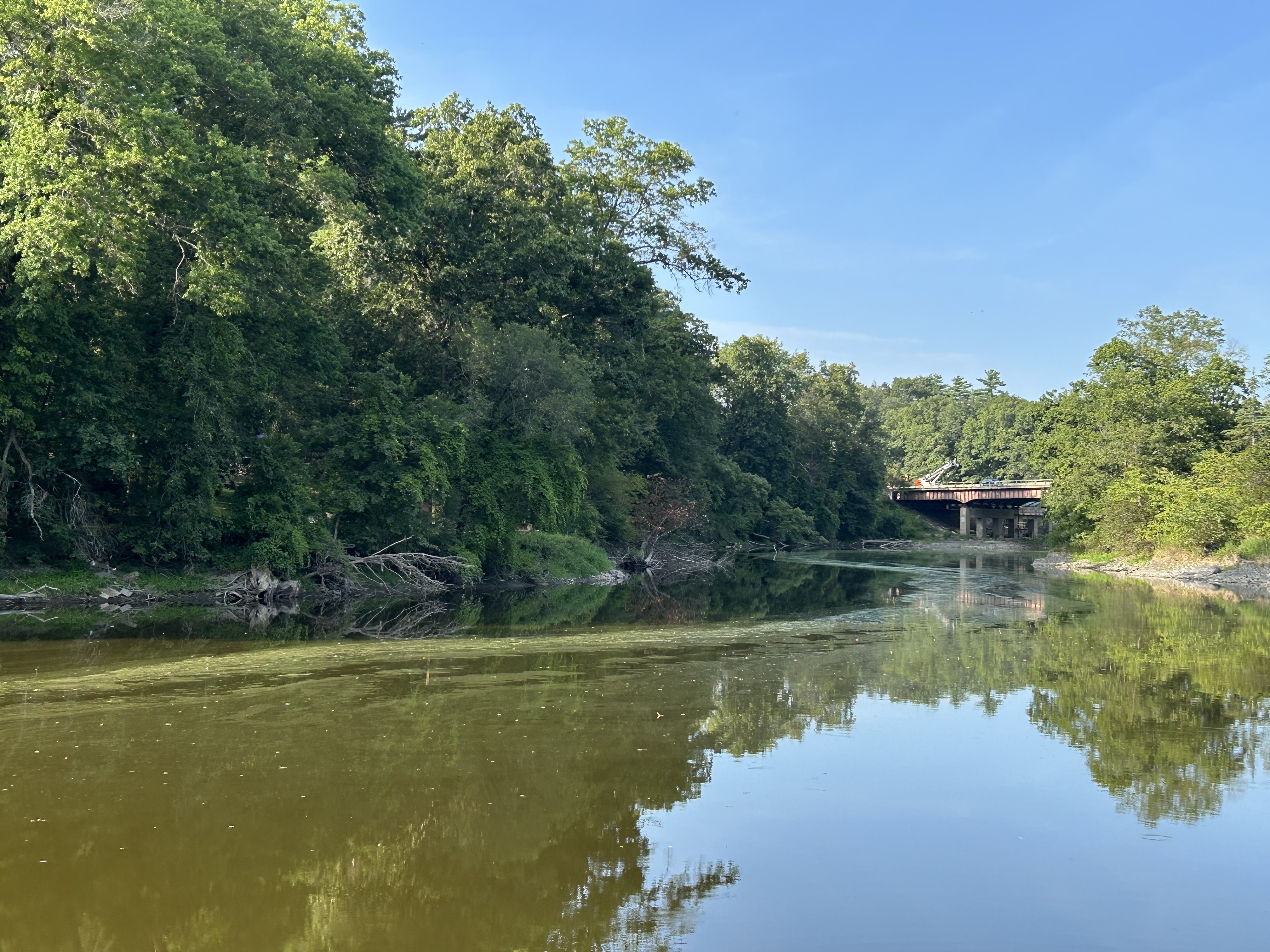
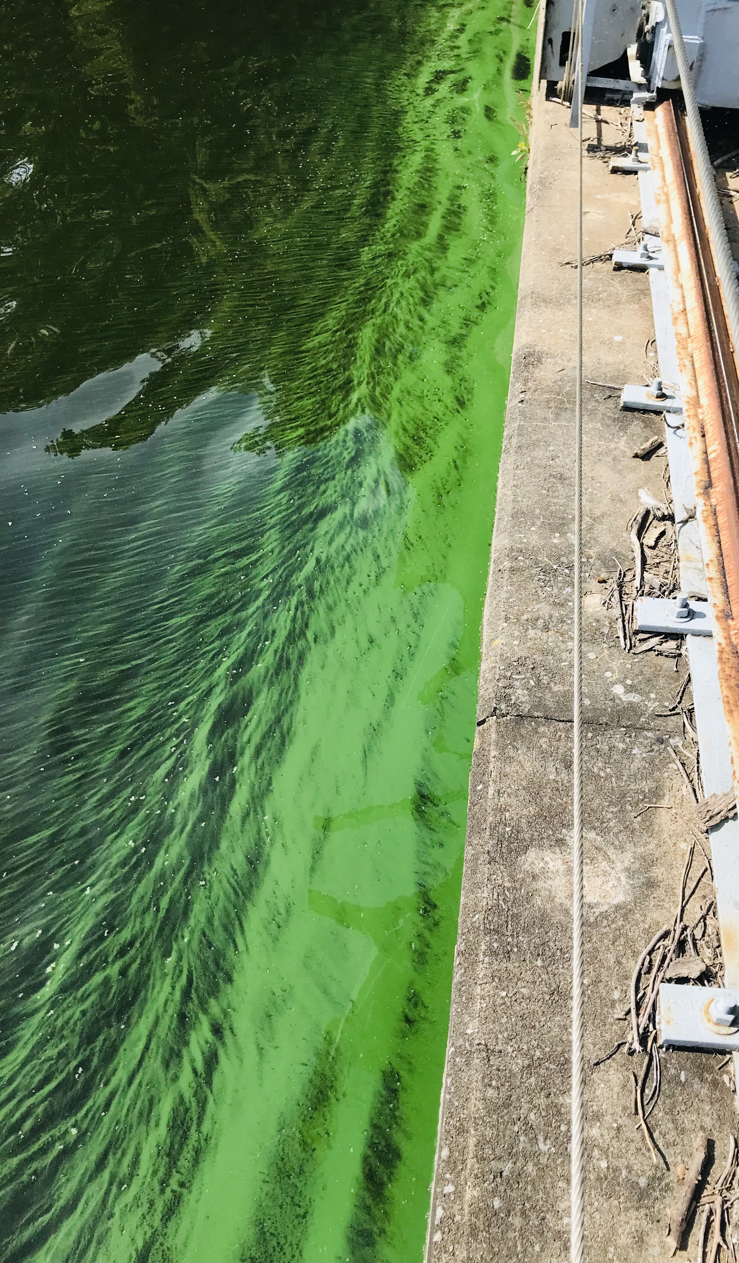
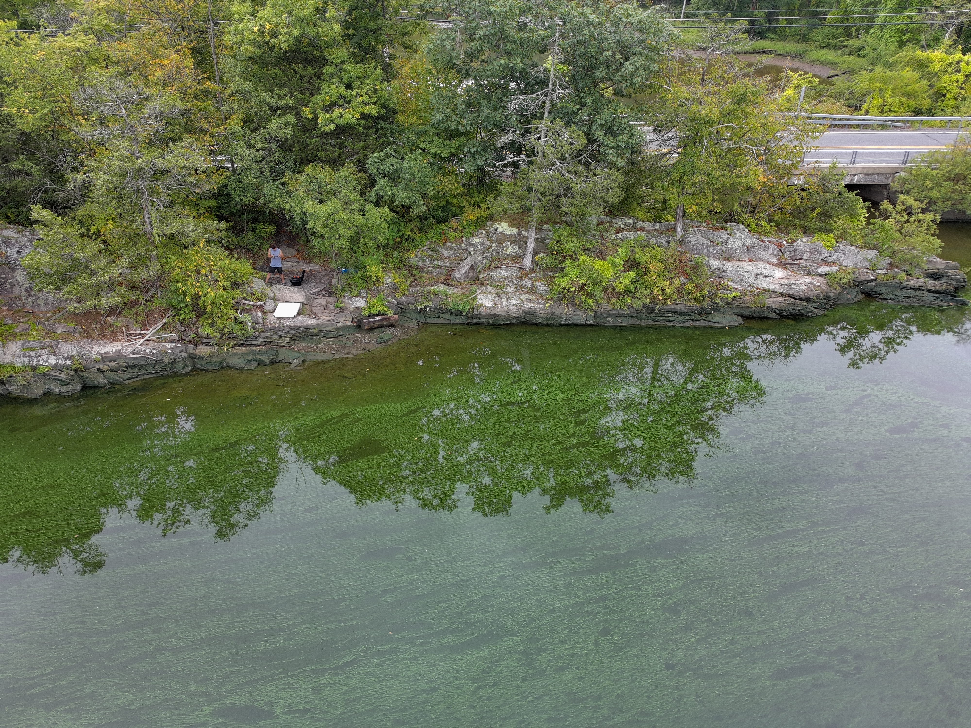
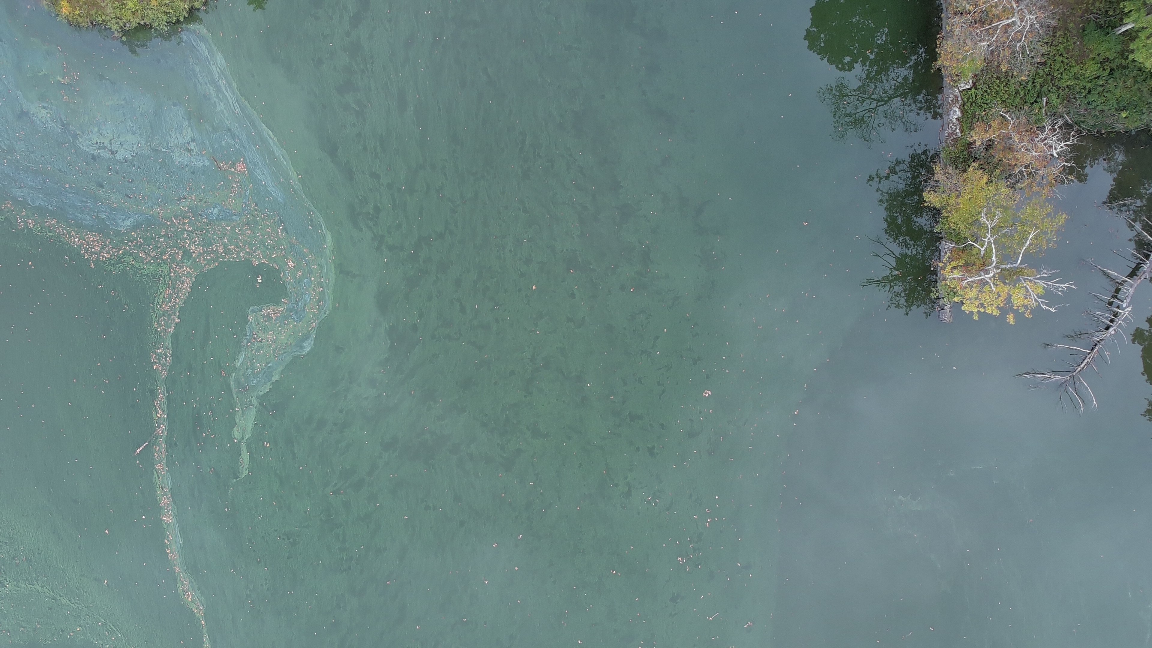
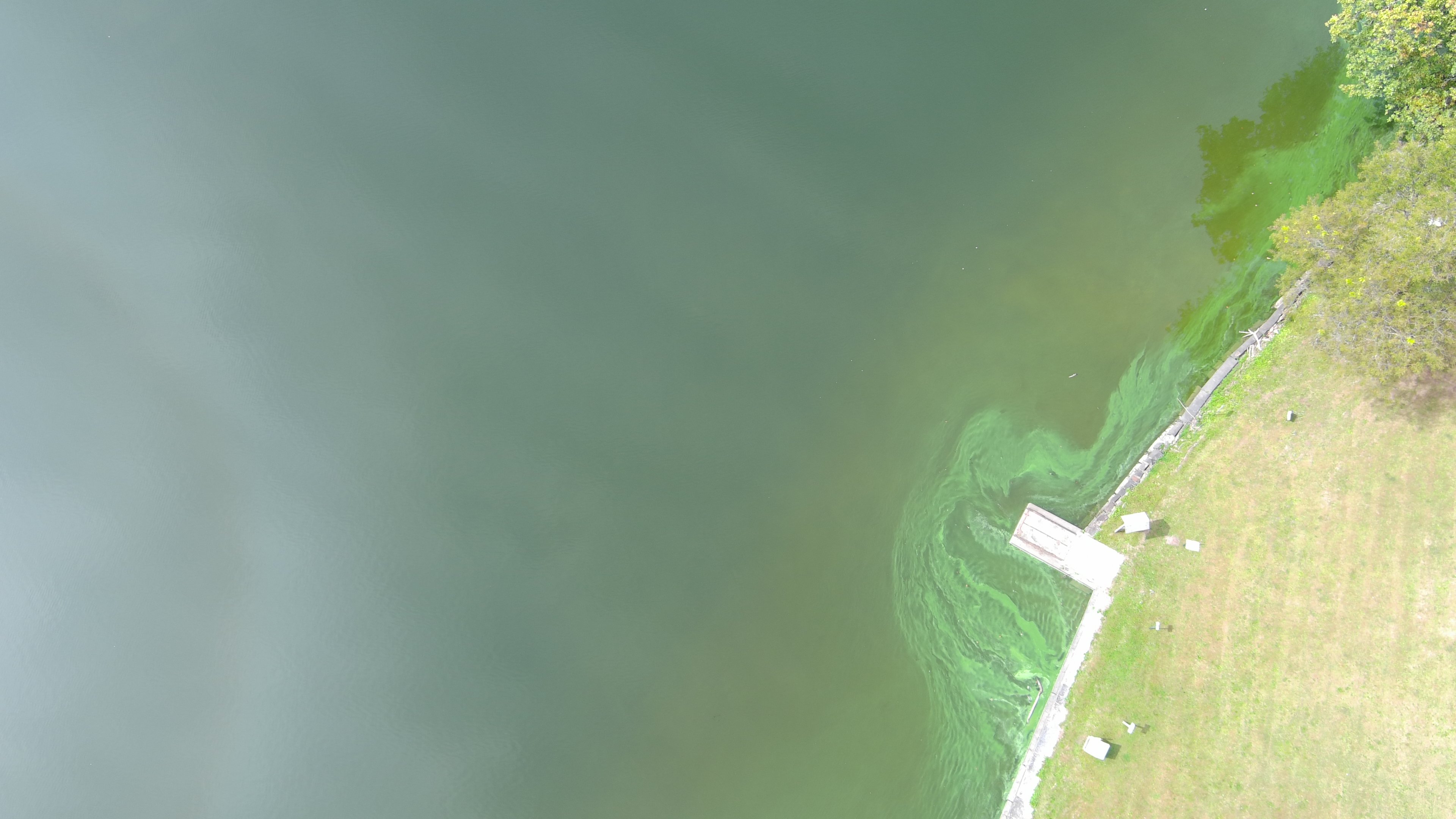
Photographs document appearance at a place and time; the DEC matches are by date and location, not laboratory results from these images. They do not establish toxin levels or the cause of a bloom. [24]
Dated visual record of the pool on the day of the hero photograph. It is not a current bloom alert or evidence of cause. The map is supplied by an external service.
What the record shows
60 / 66
mainstem bloom reports fall within the two dammed pools.
New York mainstem Wallkill + Sturgeon Pool · May 2015–October 6, 2026 · DEC Monitoring Portal and NYHABS data as of October 8, 2026. [22]
| Zone | Reports |
|---|---|
| Sturgeon Pool (dam to Dashville dam) | 37 |
| Dashville–New Paltz pool (about 10 miles) | 23 |
| Rest of the New York mainstem | 6 |
| Total | 66 |
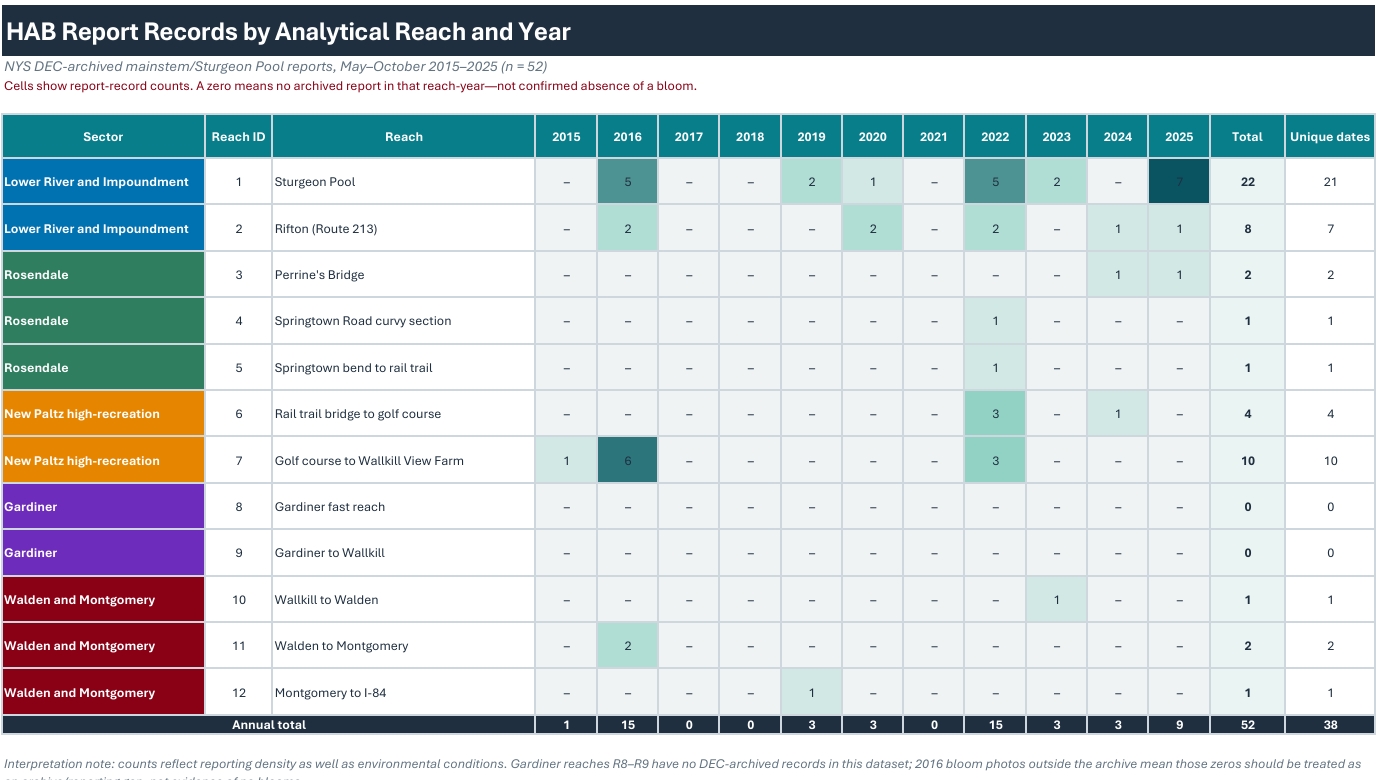
Reports classified by DEC as suspicious, confirmed, or confirmed with high toxins. They are not a count of separate bloom events or of toxic blooms. Counting confirmed reports only: 50 of 56 (89%) fall in the two pools. Counting distinct report dates: 49 zone-days, 30 of them in Sturgeon Pool. [22]
Where the river slows, the reports cluster
60 of 66 reports sit in the two dammed pools.
Public mainstem Wallkill and Sturgeon Pool, May 2015–October 6, 2026. DEC data as of October 8, 2026.
90.9%60 of 66 in the two pools, at the approximate 10-mile limit
37Sturgeon Pool, from its dam up to the Dashville dam
23Dashville–New Paltz pool, about 10 miles above the dam
6Rest of the New York mainstem
Schematic profile. Not a survey, and not to scale. Upstream is to the right.
The flat steps are the two pools. The rise is the river above them. Dots mark the zones, not individual report locations. 90.9% uses the filing's approximate 10-mile pool. One mile shorter is 80.3%. Two miles shorter is 69.7%.
The compilation combines DEC Monitoring Portal records for 2015–2025 and NYHABS records for 2026. It excludes tributaries, separate lakes and ponds, "no bloom" samples, and the New Jersey Wallkill. Every local WRWA record matched a public record; nothing was added by hand.
The earlier page's 59 of 65 used a September 19, 2026 cutoff. The October 6, 2026 confirmed report at Sturgeon Pool brings the totals to 60 of 66. Merging same-day reports at nearly the same place yields a different measure, 59 of 65 bloom-location-days. The matching numbers are a coincidence, not the same dataset. The earlier "89 reports" figure counted the whole watershed, including lakes and tributaries; it is not a mainstem count.
By year, the raw mainstem totals are 2015: 1 · 2016: 15 · 2017: 0 · 2018: 0 · 2019: 3 · 2020: 3 · 2021: 0 · 2022: 15 · 2023: 3 · 2024: 3 · 2025: 9 · 2026: 14. The zeros mean DEC holds no bloom record for those years, not that the river was clear.
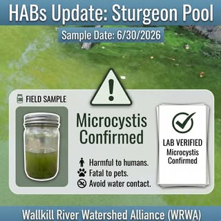
As of October 8, 2026, DEC holds 14 mainstem reports on 11 dates for the 2026 season, including a confirmed report at Sturgeon Pool on October 6. [22] On June 30, 2026, a targeted surface sample was collected at Sturgeon Pool after a volunteer HAB Watcher observation. It was lab-confirmed on July 2 at Riverkeeper's Kingston laboratory: microscopic analysis identified high concentrations of Microcystis, a toxin-producing cyanobacterium. WRWA reported the result publicly on July 3. [9] This confirms the identity and abundance of a toxin-producing organism in that sample. It is not a measurement of toxin concentration.
Lab documentation pending upload.
The year before, the U.S. Fish and Wildlife Service recorded that during the August 28, 2025 environmental site visit it "noted a harmful algal bloom in the impoundment near the intake structure" at Sturgeon Pool, and asked that blooms be treated as a potential project impact. Riverkeeper documented a bloom running from August 10 to September 25, 2025. [29] [2]
Central Hudson's July 1, 2026 progress report does not mention blooms. The lab result may have arrived after that filing; the sequence does not establish concealment. Its October 1 report says 2026 water-quality data will be provided in the April 2027 Initial Study Report. [3] [31]
New York's 2022 assessment, stored in EPA's ATTAINS database, lists Sturgeon Pond (Sturgeon Pool) as impaired for phosphorus and dissolved oxygen, and the Lower and Middle Wallkill for phosphorus and pH. All three are rated "Not Supporting" for fishing and for primary and secondary contact recreation. These are water-quality findings; they do not assign responsibility to a dam. [25]
| Waterbody / assessment unit | Listed concerns |
|---|---|
| Sturgeon Pond · NY1306-0037 | Phosphorus; dissolved oxygen |
| Lower Wallkill · NY1306-0027 | Phosphorus; pH |
| Middle Wallkill · NY1306-0038 | Phosphorus; pH |
Other parameters meet criteria or lack enough information; this table selects the listed impairment parameters. The assessment is dated and is not a current bloom advisory. Inspect the saved agency records (text)
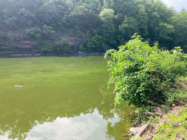
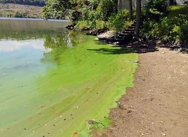
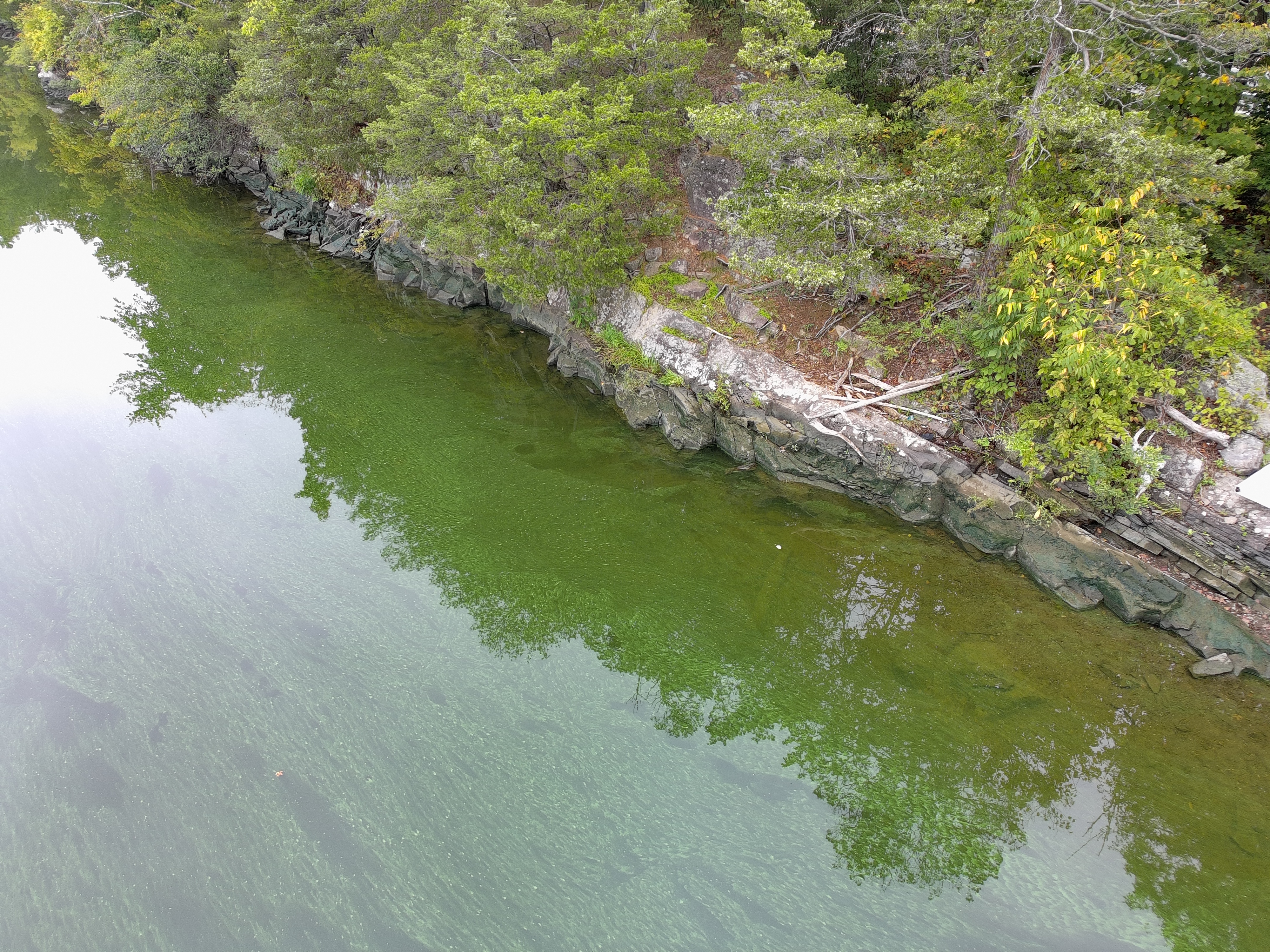
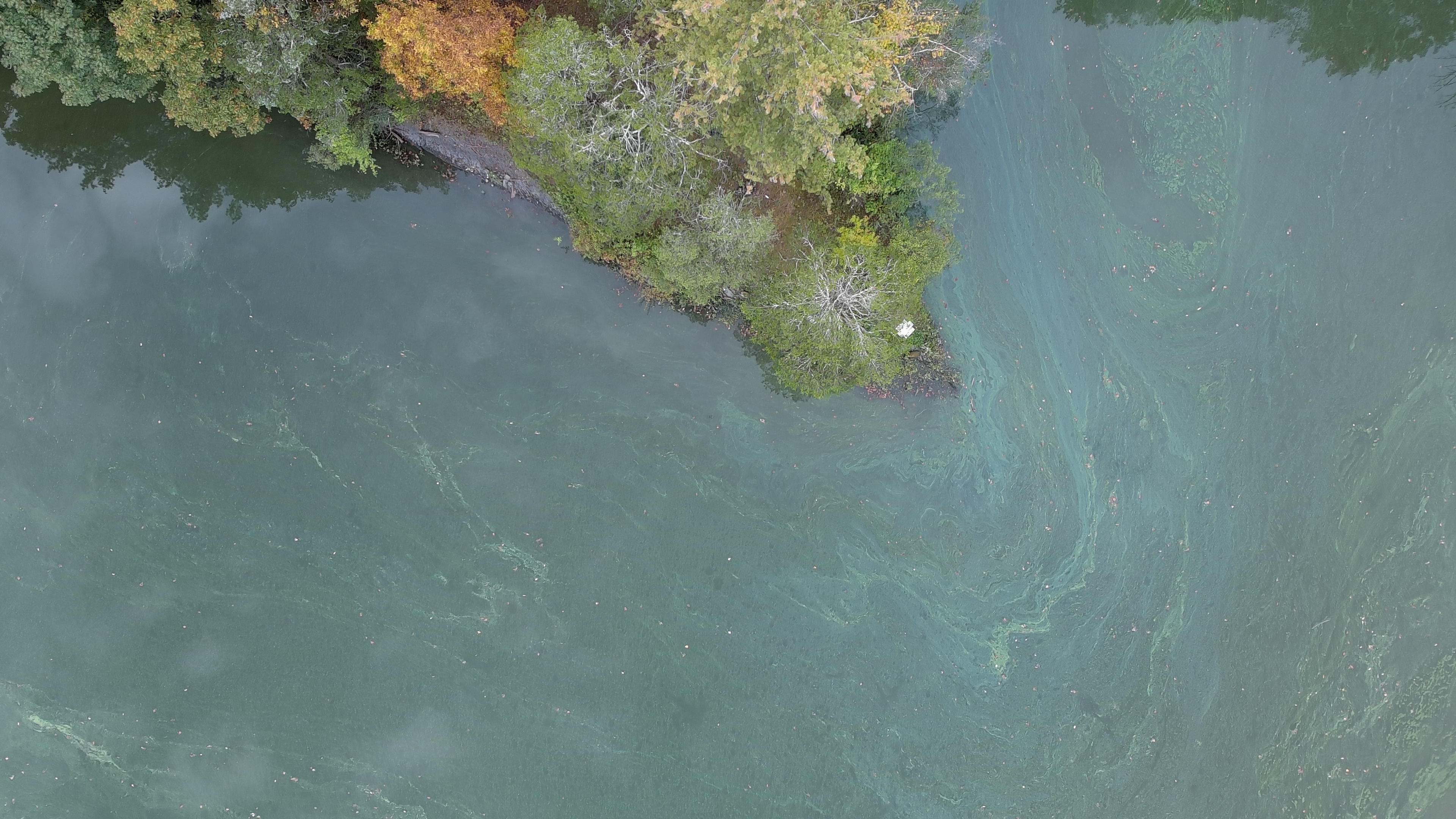
Photographs show visible conditions, not toxin levels or cause. Dates follow the project photo register. [24]
What remains unresolved
Harmful algal blooms (HABs) are overgrowths of cyanobacteria, often called blue-green algae. Some produce toxins. Nutrients, heat, sunlight, and slow water all feed them. The licensing studies are the first chance to measure how much the dams add. [24]
FERC staff wrote that "peaking operations at the Sturgeon Pool Project may increase the residence time of project waters in a manner that would exacerbate algal (chlorophyll-a) or nutrient levels," and that project operation may also influence water temperature. That is the agency's reason to sample nutrients; it is a study question, not a measured share. [2]
Central Hudson points to FERC's Walden Hydro order, which attributed blooms upstream primarily to excess nutrient loading. Upstream nutrients are real; they do not resolve what slow, warm pool water does with them. The river drains about 783 square miles, roughly 22% agriculture and 15% developed land. [2] [28]
The filings put Sturgeon Pool at 2,894 acre-feet. DEC's lake map lists 194 acres at a mean depth of 34.4 feet, about 6,674 acre-feet. Central Hudson's own pre-application document gives 251 acres and a 34-foot mean depth, which multiplies to roughly 8,500. Residence time cannot be estimated until the volume is settled, and the applicant has offered flood-study profiles instead of a survey. [26] [27] [37] [39]
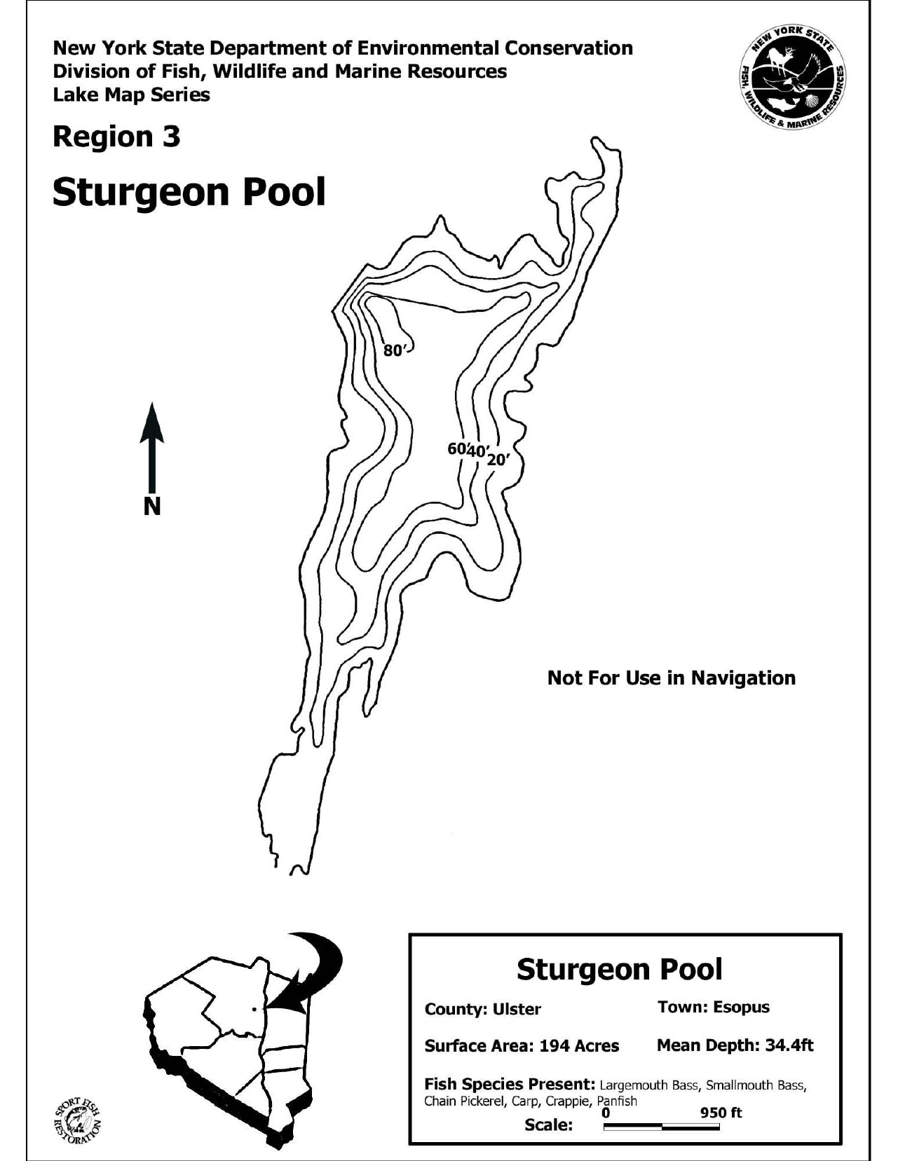
The sources may differ in age, coverage, water level, or how storage is defined. The gap does not show which is right or that anyone misstated anything. It does show that the licensing record needs a current depth-and-volume survey tied to a stated water level and datum. NYSDEC has already asked how deep the Sturgeon Pool monitors will sit, noting the pool "has varied depths." [30]
NYSDEC asked for a bathymetric survey "accurately mapping water depths and underwater profiles," and Riverkeeper supported it. In its March 2026 Revised Study Plan, Central Hudson instead said it "will provide the results of the Federal Emergency Management Agency (FEMA) Flood Insurance Study conducted in Ulster County (Flood insurance study number 36111CV004B) that documented water depths and underwater profiles for the majority of the Dashville reservoir." [37]
Those FEMA profiles are hydraulic-model cross-sections drawn for flood mapping. In the project's first look at the digital sections, they are spaced 0.1 to 1.3 miles apart, none lies within half a mile of the Dashville dam, and the datum of the filed 172.5-foot pool level is unstated. They give channel depths of roughly 3 to 19 feet at the sections, against the pre-application document's own stated maximum of 38 feet for the Dashville pool. They cannot stand in for a survey. [36] [39]
Volume divided by upstream gauge flow would be an idealized scenario, not a measurement of how long water actually sits in an operating pool. The FEMA depth figures are a provisional screening read, not a published result.
The project's GIS analysis maps about 783 square miles draining toward Sturgeon Pool. Its 2021 land-cover summary is roughly 22% agriculture, 15% developed land, 45% forest, and 15% wetland. [28]
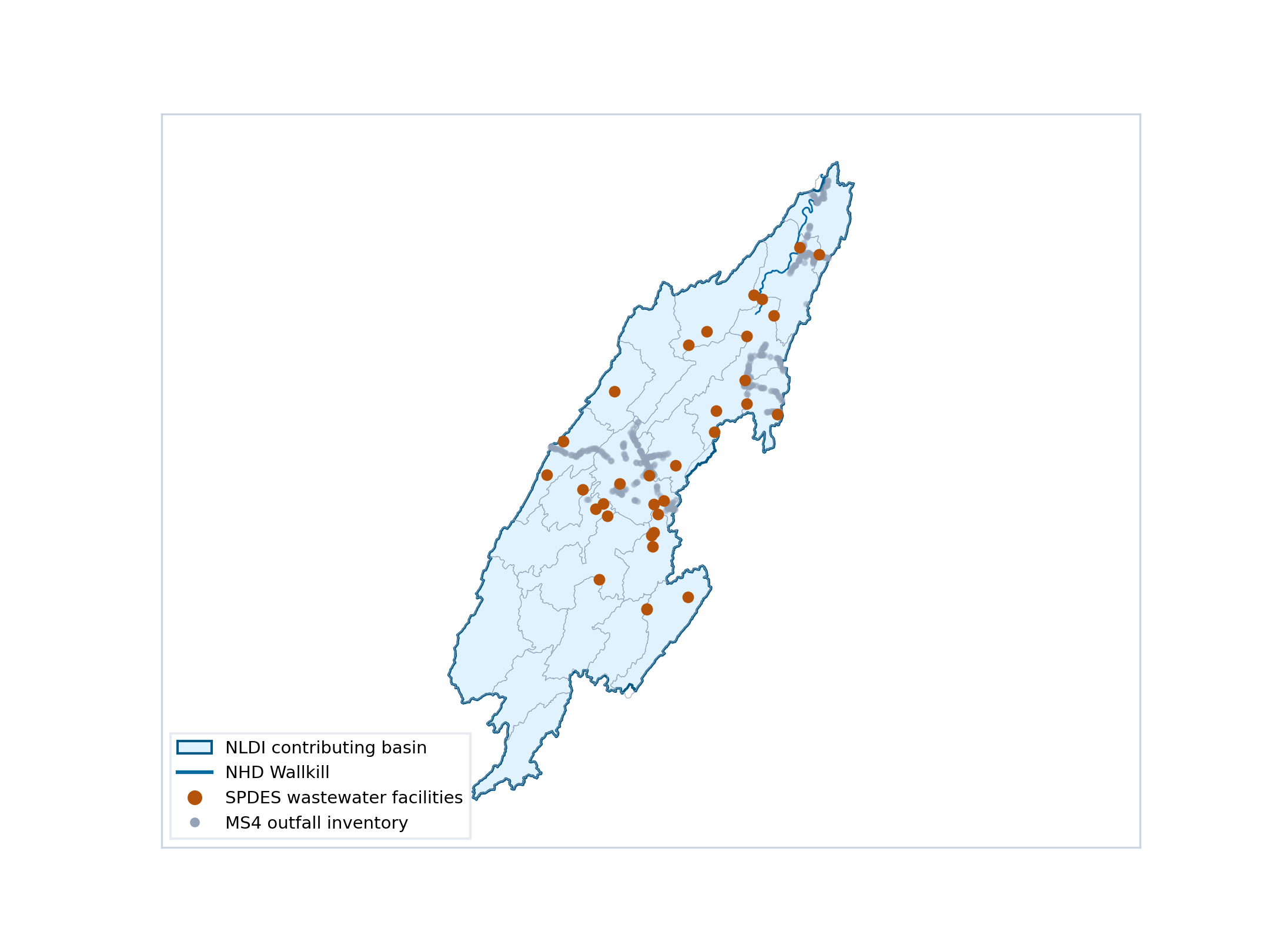
The map also locates wastewater facilities and stormwater outfalls. These are places to investigate inputs. Their presence does not measure a nutrient load, establish a violation, or show how much any source contributes to blooms.
The study question: how do nutrients arriving from the watershed interact with water movement and conditions inside each pool?
Percentages summarize NLCD 2021 pixels within the project's contributing basin. Newer crop-cover data in the project uses different categories and is not a directly comparable trend.
The Gardiner gauge (USGS 01371500) sits upstream of both dams. It measures what flows into the pools, not what Central Hudson releases. The earlier page's 2026 chart below plotted provisional 15-minute flow averages against report days, and two of its twelve marked days (July 26 and August 27) were non-mainstem reports. It is retained for traceability; it is not a current mainstem analysis, and its 300 cfs line is an illustrative reference, not a proven bloom threshold. [12]
Blue line: upstream daily flow. Red circles: report days. A rebuilt comparison of all 66 report dates against official USGS daily values is a planned follow-up; it was not completed for this revision and no flow threshold is claimed here. [12] [22]
The filings and who owns the dams
The Federal Energy Regulatory Commission (FERC) licenses hydroelectric projects on navigable rivers. For a hundred years these two were never licensed.
USFWS asked FERC in 2019 to decide whether the projects needed licenses. Central Hudson argued that a 1919 New York Conservation Commission permit for the Dashville dam was still valid and barred FERC jurisdiction. New York's own environmental agency disagreed: NYSDEC told FERC in January 2021 that the 1919 approval, like the July 1922 approval for Sturgeon Pool, was "for construction only," and that "neither the Dashville nor the Sturgeon Pool dam facilities has a permit to operate the dam, as Central Hudson claims." [35]
On February 6, 2025, FERC found that the projects sit on a navigable waterway, hold no valid pre-1920 federal permit, and must be licensed. Central Hudson filed its notice of intent on May 30, 2025. [1] [19] [29]
Who owns them: Central Hudson Gas & Electric "is a subsidiary of CH Energy Group and an indirect wholly-owned subsidiary of Fortis," in its parent's own words. Ownership identifies who answers in the licensing; it does not by itself establish responsibility for any bloom. [8]
Before FERC can issue a license, New York must grant or waive a Clean Water Act §401 water-quality certification, and NYSDEC can attach conditions. That is the state's lever. [16]
New York's Conservation Commission approves construction of the Dashville dam (United Hudson Electric Corporation) and, on July 19, 1922, the Sturgeon Pool dam. [35]
USFWS asks FERC for an updated jurisdictional determination. [29]
NYSDEC rebuts Central Hudson's pre-1920 permit argument: construction approvals only; no permit to operate. [35]
FERC finds federal licensing required (190 FERC ¶ 62,077). [1]
Central Hudson files its notice of intent and pre-application document. [19]
USFWS files study requests; reports a bloom seen near the Sturgeon Pool intake. [29]
NYSDEC asks again for an April 15–November 15 monitoring season and for monitor depths. [30]
FERC issues its study-plan determination. [2]
First study progress report; no mention of blooms. [3]
Second progress report: monitoring and field studies under way. [31]
Initial Study Report due. A study deadline, not a comment deadline. [2]
Central Hudson's October 2020 comments claimed a valid pre-1920 state permit. NYSDEC's reply: the 1919 and 1922 approvals were construction approvals, distinct from any approval to operate, so state law "does not appear to prohibit FERC licensing." FERC ordered licensing four years later. [35] [1]
FERC staff wrote that Sturgeon Pool's peaking operations "may increase the residence time of project waters in a manner that would exacerbate algal (chlorophyll-a) or nutrient levels." [2]
Central Hudson said it was "not adopting" requests to monitor nitrogen, phosphorus and chlorophyll-a, citing the lack of state standards and of evidence. FERC required biweekly grab samples for all three anyway. [2]
NYSDEC and USFWS requested April 15–November 15. FERC approved June 1–October 31, saying earlier spring sampling was not justified. [2] [30]
Riverkeeper's proposed cumulative-effects cyanobacteria study (Study 15), with daily phycocyanin and weekly nutrient sampling, was not required. FERC instead ordered Central Hudson to document any observed bloom across the whole June–October season, not just on biweekly visits. No phycocyanin or toxin testing was required. [2]
USFWS: "The Projects currently do not release any continuous minimum flows," and flows below Sturgeon Pool "can vary daily from low-leakage to no flow conditions to 1,833 cubic feet per second." USFWS asked for a base-flow study and bypass-reach flow evaluation. [29]
Central Hudson cited the Walden Hydro order (185 FERC ¶ 62,097) to argue that nutrient loading, not hydropower, drives blooms. Upstream sources are real; the filing position does not resolve the contribution of project operations. [2]
Confirmed from a primary document: Central Hudson "is a subsidiary of CH Energy Group and an indirect wholly-owned subsidiary of Fortis" (CH Energy Group, unaudited Q2 2026 financial statements, Note 1). [8] The New York PSC approved Fortis's acquisition of CH Energy Group in Case 12-M-0192 (order of June 26, 2013). [18]
The earlier page also showed the chain below and stated a $65-per-share price, a "Federation Model" of local management, and a 6.1% stake in NY Transco. Those details were not confirmed against primary filings for this revision and are shown for traceability only.
The twelve-year gap between the 2013 acquisition and the 2025 licensing filing is a matter of dates in the public record. The record does not establish what Fortis knew at acquisition or why the filing came when it did.
This material is not evidence of bloom causation. It is retained because the earlier page discussed it and readers may look for it.
Billing-system proceedings. The PSC investigated Central Hudson's billing-system rollout (Matter 22-00666; Cases 22-M-0645 and 22-E-0121). On January 30, 2023, Central Hudson requested confidential treatment for material attached to a response. A request is not a Commission ruling and does not establish concealment. [6]
Former gas-plant cleanup. Central Hudson's 2021 Site Investigation and Remediation report recorded $116,485,802 in costs through December 31, 2021 across nine sites, overseen in PSC Case 11-M-0034. These are historical figures about former manufactured-gas-plant sites, not about the dams. [5] [14] [15]
Financial filings. Regulatory returns for the rate year ended June 30, 2026 and the unaudited CH Energy Group Q2 2026 statements document corporate reporting, not project-specific funds. [7] [8]
Court cases. This review found no active environment-specific civil case concerning the two projects. FERC licensing and PSC/NYSDEC oversight are administrative proceedings, not lawsuits. The search was bounded, not exhaustive.
Take action
These are the asks of Still Waters and the Wallkill River Watershed Alliance. Each one is tied to something already in the record. None presumes the answer; each demands that the licenses be built to find it.
P-15396 Sturgeon Pool
P-15397 Dashville
eComment is for individuals filing on their own behalf. Organizations, attachments, and motions to intervene use eFiling. Filing a comment does not make you an intervenor. Check the docket for current notices. [23]
Sources and sharing
Agency records, the project's data compilation, and community observations are kept distinct below. Source numbers from the earlier page are retained so older citations still resolve; new entries continue the sequence.
Retained for comparison only. This is the earlier page's reach-based 59/65 table (data through September 19, 2026). Its reach definitions differ from the three-zone tally and its "25 of 65 in Reach 1" figure is no longer used. See the current tally.
| Reach | Sector | River miles | Reports |
|---|---|---|---|
| 1 · Sturgeon Pool | Impoundment | 0.5–1.4 | 25 |
| 2 · Rifton (Route 213) | Impoundment | 1.4–2.9 | 11 |
| 3 · Perrine's Bridge | Impoundment | 2.9–6.5 | 2 |
| 4 · Springtown curvy reach | Impoundment | See map | 0 |
| 5 · Springtown bend | Impoundment | See map | 1 |
| 6 · Rail trail to golf course | Impoundment | See map | 5 |
| 7 · Golf course to Wallkill View Farm | Impoundment | See map | 15 |
| 8–9 · Gardiner | Upstream | 12.0–24.0 | 0* |
| 10–12 · Walden & Montgomery | Upstream | 24.0–38.0 | 6 |
| Impoundment total (Reaches 1–7) | 59 / 65 | ||
Counts and methods are a dated project compilation, not an independent causal study. External links and hosted documents remain under their publishers' control.
assets/.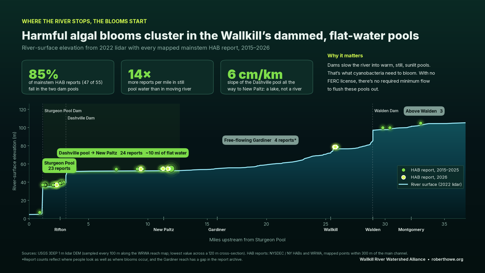
A short starting point for your comment
Regarding Sturgeon Pool (P-15396) and Dashville (P-15397): I am concerned about the recurring harmful algal blooms in the project impoundments. Please require the licenses to evaluate minimum flows and summer operations that prevent stagnation; a cyanobacteria study that measures phycocyanin, toxins, nutrients, temperature and residence time from April through November; a current depth-and-volume survey of both pools; prompt public reporting of observed blooms; adequate mussel, fish and eel studies; and formal, safe public access with warning signs. I ask that the studies be designed to determine how much project operations contribute to these blooms.
Add your own experience. Comments in your own words carry more weight than copied text.